
Have I mentioned how much I love the High Rockies Trail? I might have done. Like here, here, and here. Until now, if I was pushed to find fault with this trail, at least the sections i’ve explored, the most I could manage is to complain about the trees – that as amazing, challenging and fun as the trail is to run, you spend a lot of time staring at trees. Lots of trees. This week’s run, however, a 10km out-and-back from the Mount Buller day use area, with 590m of elevation, changed all that. Yes, there was still beaucoup de trees. But there were also magnificent sections of exposed trail that lay the valley bare before you. On a clear, bluebird kind of day, it would be absolutely stunning.
On Movescount, it all looked like this:


The Mount Buller day use area is about 35 minutes from Canmore, along Highway 742. The trailhead is actually across the highway from the turn off for the day use area. It’s reasonably hard to miss. It’s also the trailhead for Buller Pass, Guinns Pass Trail and Ribbon Lake:

The trail climbs steadily through the – wait for it – trees, and after 1km brings you to the footbridge over Buller Creek:

Once over the bridge, the trail to Buller Pass etc., veers off to the right up a short, steep bank, while the High Rockies Trail continues straight ahead:

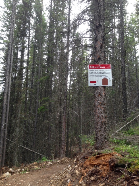
There was a sign warning of “open excavations” and indeed, the trail looks like it’s still a work in progress for a few hundred metres. After that, however, the trail seems more “complete” though there’s an additional warning – of the unexploded bomb variety:
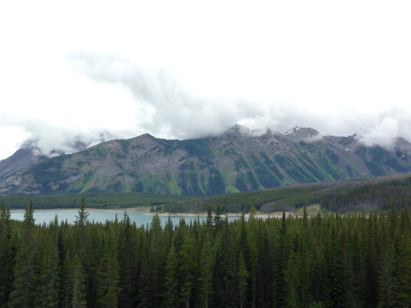
After another kilometre or so, the trail really begins to open up, with great views across the Spray Valley and upwards towards Mount Buller:


The trail continues along, in its nice undulating, rollercoaster fashion, alternating between sections of rooty forest and more exposed and rocky avalanche slopes that offer fabulous views along the way:


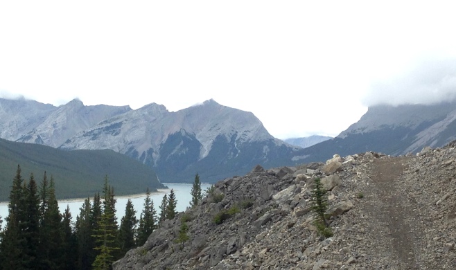
Given that these are avalanche slopes, this section of trail is likely to be closed during the winter.
I chose to turnaround after 5km which, happily, coincided with the last of these exposed sections, and was then treated to some further great views of the valley on the return to the trailhead:

If you don’t turnaround but continue onwards you’ll reach the connectors for the Spray Lakes, Sparrowhawk and Driftwood day use areas.
Like I said, on a clear day the views would be absolutely stunning. Not that they were too shabby on a dull, overcast and slightly wet kind of day.
Until next time, happy trails.

Great photos and trails. You’re lucky to be able to run there =)
LikeLike