Located at the northwestern end of Mount Lawrence Grassi, Ha Ling looms large over Canmore, along with its fellow Canmore Quad peaks of Lady Mac, East End of Rundle and Grotto. At an altitude of 2,407m, it’s the lowest of the Quad summits and with a distance of 3km from trailhead to peak makes for a relatively speedy if technical climb along some switchbacking rocky and root strewn singletrack that eventually gives way to scree followed by a short scramble over rock to the summit. Once there, the views are stunning.
Originally, the mountain was referred to locally as the Beehive. That changed in 1896 when Ha Ling, a Chinese cook with the Canadian Pacific Railway was bet $50 that he couldn’t climb the peak and plant a flag on the summit in less than 10 hours. He was reported to have started his ascent at 7am on a Saturday morning and was back down in time for lunch. As no one believed that he’d managed the climb he subsequently led a party of “doubters” to the summit where he planted a second, larger, flag that was visible from Canmore. Locals referred to the peak as Chinaman’s Peak in his honour and was later renamed Ha Ling in 1997. 120 years on from that first ascent, the trail to the summit is well-trodden, this being one of the more popular hikes in the area – something to consider when planning you’re own ascent as the trail can become crowded, especially on summer weekends.
The 3km trail comes with 845m of elevation so, needless to say, it’s steep in places. I know of at least one person who’s run the entire ascent. For most of us mere mortals though, I suspect it’s more of a power hike with occasional running where the gradient allows. On Strava it looks like this:


The trailhead is across from the Goat Creek day use area on Highway 742, just past Whitemans Pond and very close to the trailhead for the East End of Rundle. Go past the gate (shown below) and follow the gravel slope upwards:

Take the bridge across the canal and then look ahead of you for the start of the trail with its plaque commemorating the miners who worked beneath the mountain:

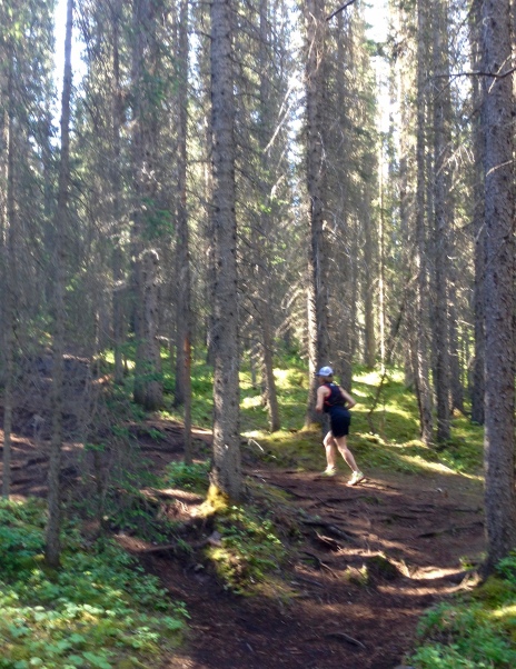
The trail goes immediately into the trees and gradually winds its way up over tree roots and soft, almost bouncy, ground, becoming gradually steeper the more you climb:

Eventually, the bouncy ground becomes rocky but still rooty and, at times, steep singletrack that continues to wind its way up up through the trees:

After 1km or so you begin to reap some reward for your efforts as the Goat Range begins to emerge from the trees:


After around 2km, the trail leaves the the trees and becomes looser underfoot:

It’s not far now to the last switchback after which you start the final approach, continuing on the loose stuff to begin with, followed by more of a scramble over the rock to reach the summit:


And once there, it’s time to sit back and take it all in:


If you’re not done with the alpine, Miner’s Peak (above) can be easily accessed from Ha Ling. Otherwise, there’s really only one thing to do and that’s retrace your steps and enjoy the speedy descent back down the mountain:

Until next time, happy trails.
2 thoughts on “Ha Ling”