I’m a bit late to the party, having been AWOL for so long, but feel it’s important to mention that the Government of Alberta (GoA) is gathering feedback until July 22nd for the development of the new Canmore Area Trails Strategy (CATS). The strategy will establish an integrated recreational trail system across Crown land within the Bow Valley. The public feedback survey can be found here.
According to GoA, the strategy is designed “to address growing demand for trails in the Canmore area, providing world-renowned recreational opportunities while protecting local wildlife and conserving habitat. This engagement will contribute to a Crown land trails plan for the area and also support an update to the trails plan for the Canmore Nordic Centre Provincial Park.”
Input from trail users, as well as ongoing consultation with an advisory group including Indigenous communities and organizations, leaseholders, area landowners and local community organizations, will support “improved recreational infrastructure and services in the Canmore area and the Bow Valley, ensuring that local trails may be enjoyed now and for years to come.”
In addition to the public survey, there’s also an opportunity to use an interactive map to identify trail-related issues, such as a lack of parking, a lack of signage, the need for toilets, etc. The interactive map can be found here.
The Canmore Area Mountain Bike Association (CAMBA) and the Bow Valley Climbers Access Society are among local groups promoting engagement with the CATS process and survey. Laura Quelch, the executive director of CAMBA has said that CATS is “crucial for enhancing outdoor recreational opportunities while preserving the area’s natural environment.” The strategy will “streamline trail development and management, ensuring responsible practices and diverse trail offerings that meet the community’s needs.”
Oh, I know. It’s been a long time since I last posted – a whole two years in fact – and even longer since I last raced, at the Wandering Moose in Kelowna, BC in October 2022. In an effort to correct both these lapses, I took part in the recent 5 Peaks Powderface Mountain Marathon, in beautiful Kananaskis, an hour east of Canmore, and am now writing about it…
Mount Cascade from the Bow River PC: Canmore Runner
I am the king of the hiatus! I make these pronouncements about being back – I literally said, “and we’re back” and then i’m gone again for a period of months. This time around, it can be explained in part by the fact that I haven’t been up to anything new on the trail running front. I pounded up and down the Powerline trail for much of winter and spring, gaining the double-edged Strava “local legend” title in the process – an accolade which of course accentuates the pounding. But the Powerline is not the most thrilling of trails to run, let alone write about.
I’m also still beset with this heightened anxiety about bears which manifests in a sensible tendency to not run alone, especially somewhere new. And not without reason. Ms Canmore Runner and I ran straight into a, luckily uninterested, grizzly on the Loki trail in April.
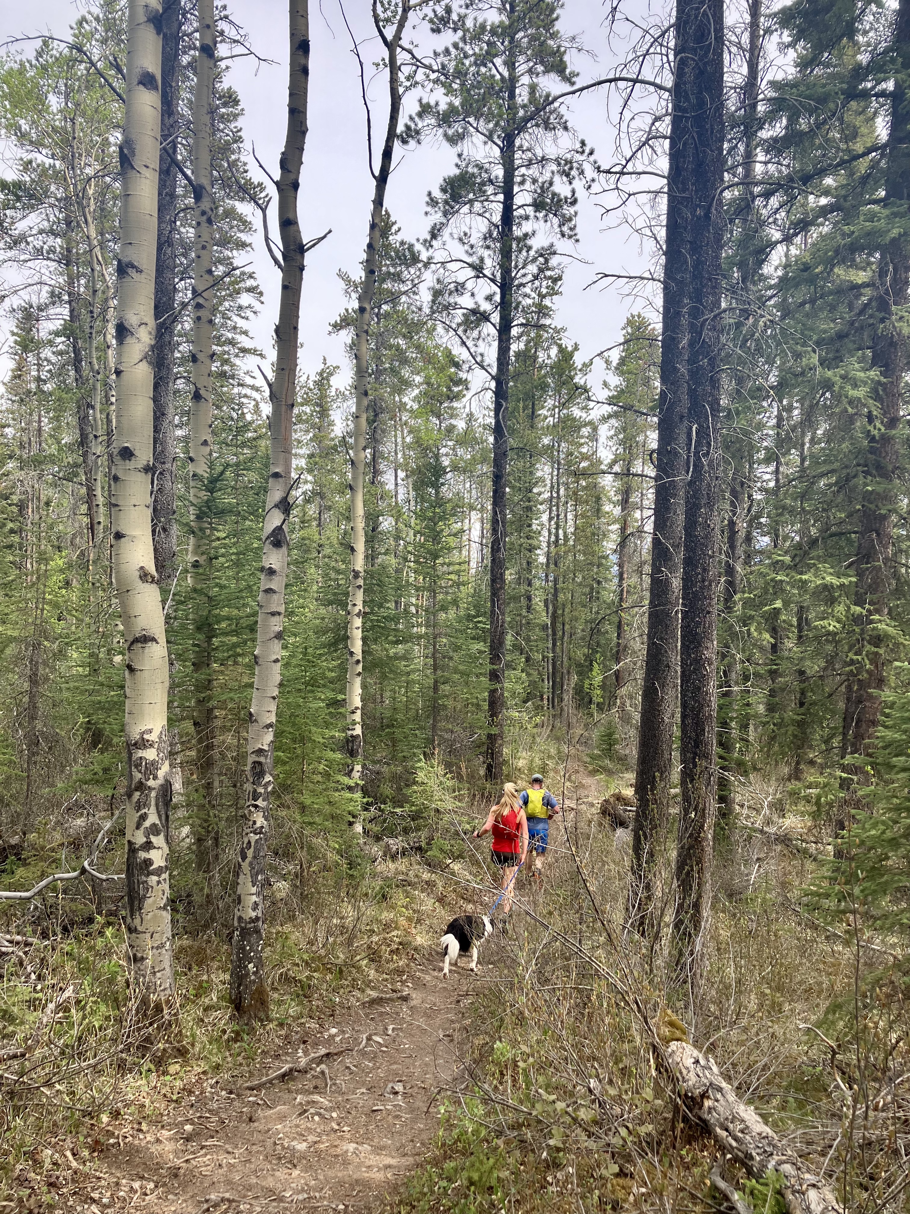
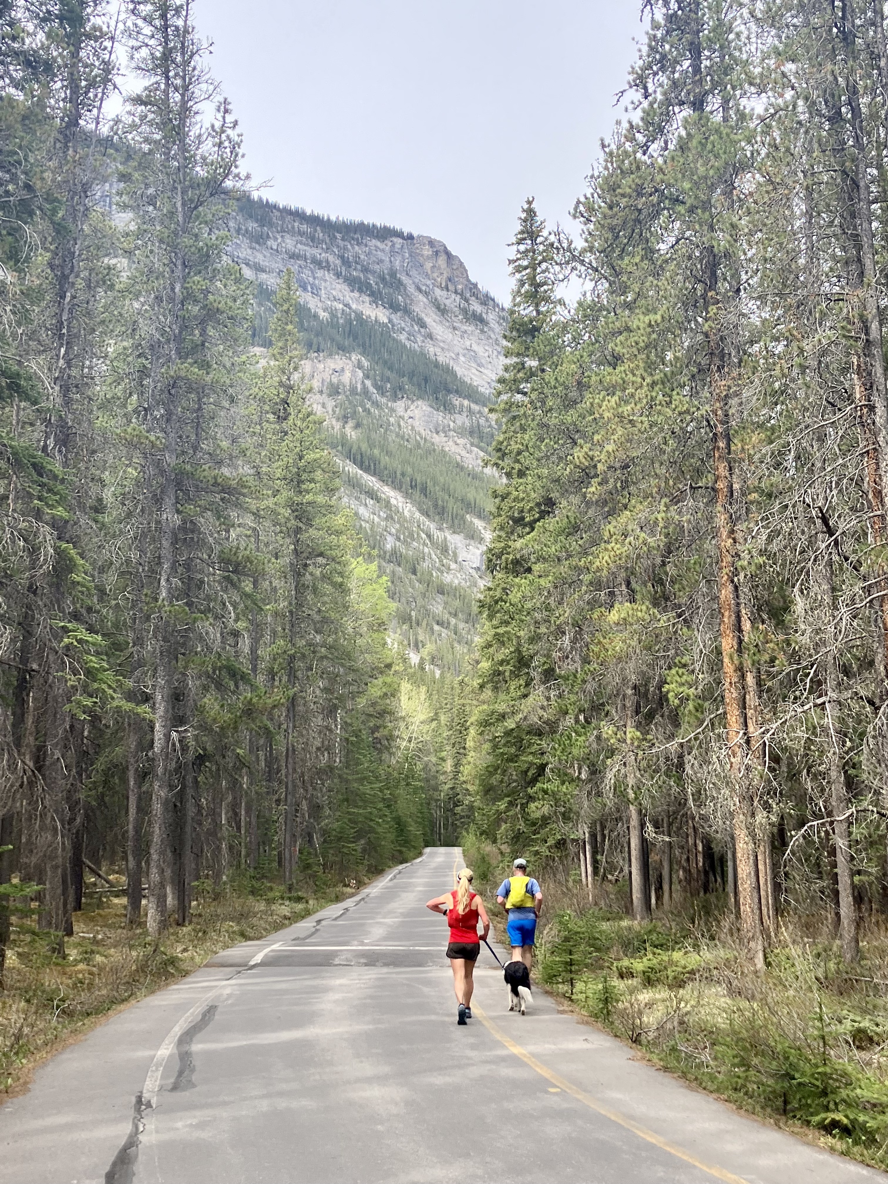
All that to say, I was very pleased when my good friend and ace local photographer Simon Lee suggested a Saturday morning jaunt from Canmore to Banff along the Rundle Riverside Trail, as part of his quest to get fit for this year’s TransRockies. I wasn’t going to pass that up. And we were joined by the always modest, unassuming and yet powerful Bob Graham Round alumni Jennifer Shutt and Tom the border collie – on the condition that they agreed to run slowly.
We started the run at ArtsPlace in the centre of Canmore and finished at the Banff Avenue Bridge which made for a 23km run with around 770m of elevation gain which looks like this on Strava:
The most challenging part of the route was the 102m climb up to the Canmore Nordic Centre from the Bow River (via the steps next to the TransAlta plant and the Legacy Trail extension). At the Nordic Centre we picked up the Banff Trail and followed this for approximately 5km until we reached the boundary with Banff National Park and the start of the Rundle Riverside Trail.
At the Park boundary PC: Canmore Runner
You could of course start at the Nordic Centre and save yourself 3km.
This is one of those run’s that get more interesting as it goes on. Personally, I find the Banff Trail short on thrills – a gentle, easy run along a wide trail in the trees, albeit with some great views of Mount Rundle from the Mine Meadow.
Once you pick up the Rundle Riverside trail, it’s essentially single track for the next 8km. It begins with a great little descent followed by a more undulating and runnable trail all the way to the Banff Springs Golf Course.
Rundle Riverside trail PC: Canmore Runner
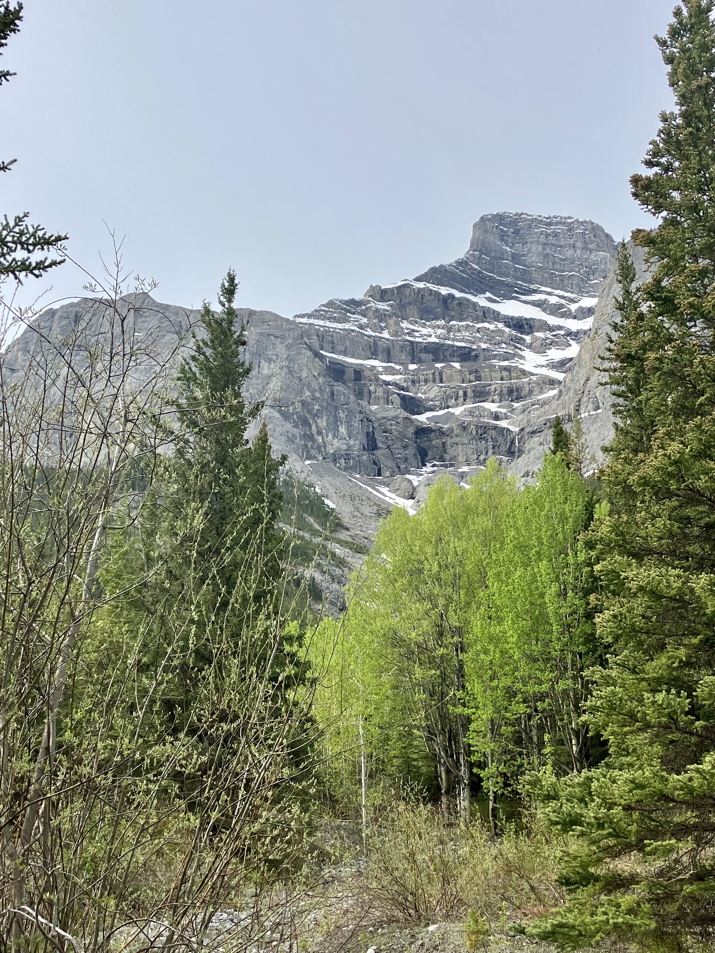
But as nice as it would be to slip into autopilot and flow along the Riverside trail, it’s also a root strewn hell for the first few kilometres. The good news is that you’re not missing much in terms of views as you concentrate on avoiding roots and rolling an ankle. It’s not until around the 14km mark that the views start to come with occasional glimpses of Mount Rundle to the left…
Mount Rundle PC: Canmore Runner
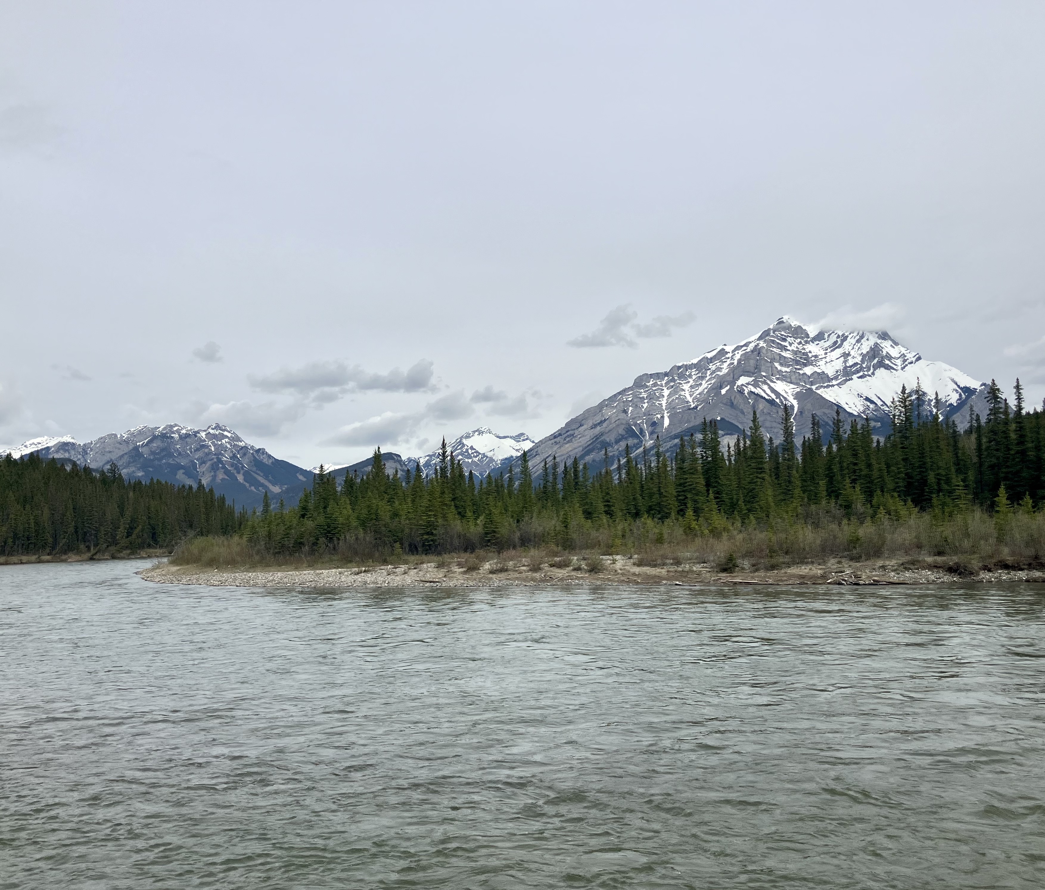
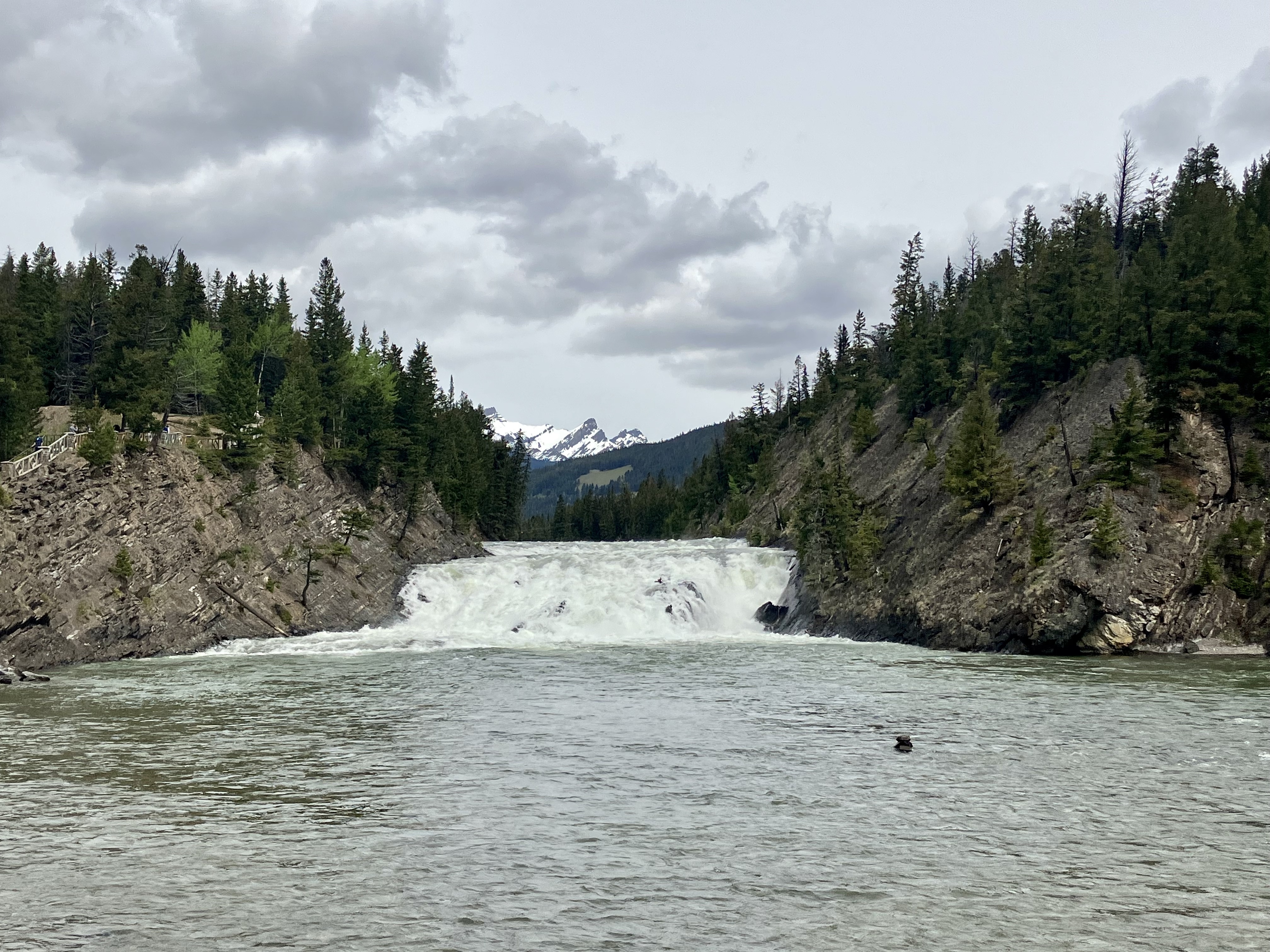
…and the Bow River to the right. The views of the latter become all the more impressive the further you go:
Bow River PC: Canmore Runner
Mount Cascade and the Bow River PC: Canmore Runner
And then, some 17km in overall, you pop out onto the Banff Springs Golf Course road. I always find the sudden transition from trail to road to be quite jarring and this was no exception, not least because it seems to go on forever…
Pavement to Banff PC: Canmore Runner
But, it’s actually only about 4km of pavement before you are rewarded with the always spectacular Bow Falls:
Bow Falls PC: Canmore Runner
Follow the trail along the bank of the Bow River to the pedestrian bridge which we crossed and then headed along the opposite bank to the until the Banff Avenue Bridge and you are done.
And then you can either do what we did and dash to catch the Roam bus back to Canmore; or, I would advise, grab yourself a nice flat white at Wildflower or Whitebark and feel good about the fact that you’ve just run from Canmore to Banff.
Yesterday saw the announcement by the Government of Alberta of both good and bad news for runners, bikers and hikers in the Bow Valley.
The good news is that the province is investing more than $4 million to upgrade the Grassi Lakes and Goat Creek day use areas “to address public safety issues and parking congestion while improving visitor experiences.” More specifically, the work will:
Expand and formalize the Grassi Lakes main parking lot.
Refurbish portions of the Grassi Lakes trail.
Formalize the Grassi Lakes overflow lot.
Provide a road crossing and trail connection between the overflow and main lots.
Provide separation and washroom facilities between the climber’s lot and the Smith Dorrien Trail.
Expand and formalize Goat Creek main parking lot.
Replace two bridges on Goat Creek trail.
According to the Government, the work has become necessary due to the significant – 32% – increase in the number of visitors to Kananaskis Country since 2019. In 2020 and 2021, the region welcomed more than 5 million visitors annually. Grassi Lakes and Goat Creek are two popular areas in the region and the increased visitation has increased the pressure on existing facilities and the landscape.
The downside of this otherwise good news is that Grassi Lakes (Canmore Nordic Centre Provincial Park), Goat Creek (Spray Valley Provincial Park) and the surrounding area will be closed while construction is ongoing.
The closure is scheduled to begin on April 1 and is expected to last until the end of the year.
In practical terms that means the following trails will be closed:
Grassi Lakes Trail
Junkyard Trail
Ha Ling Trail
Miner’s Peak Trail
Goat Creek Trail
East End of Rundle Route
Reclaimer Mountain Bike Trail
Riders of Rohan Mountain Bike Trail
access to High Rockies Trail from Goat Creek
That’s whole stack of great trails. It also means that two of the four peaks in the Canmore Quad will be off limits for the rest of the year. And without wanting to rub salt in the wounds, I should mention that a third Canmore Quad peak, Lady Mac – which has been open during the winter following a long closure due to the flood mitigation work at Cougar Creek – will close again at the end of March through to the end of the year as the mitigation work resumes. That leaves Grotto which, like Marmite, you either love or hate. Last but not least, Alberta Parks is also closing the mighty Yamnuska from 31 March for at least 5 weeks due to “unfavourable conditions” and “to protect the environment and conserve the landscape”. After that time, the trails and area will be assessed weekly, so further closures could be in the offing.
It’s probably also worth mentioning, in case you were wondering, that Alberta Parks Conservation Officers will apparently enforce the Grassi Lakes/Goat Creek area closure under the Provincial Parks Act.
After reading the Grassi Lakes/Goat Creek closure notice, a bunch of questions came to mind in terms of why such an extensive closure for so long, why not rolling closures depending on where the work is taking place etc., etc., some of which are addressed in this FAQ provided by Alberta Parks.
It’s a blow to lose access to some really great trails, just as the temperatures begin to rise, the snow and ice begin to thaw, and the mind turns to thinking about summer adventures in the valley. But the work has to happen and will, on hopes, be beneficial in the long run. It’s also only temporary and we’re lucky to have no shortage of amazing alternatives. And on a more personal note, it gives me an excuse to put off the Canmore Quad attempt for another year.
After a relatively early start, this year’s racing season has been an undulating affair and not just in terms of the topography. It began with the Torgon Trail in May, intended as a gentle start the season, followed in June by the Scenic Trail, which lived up to its name. Two weeks later, it was off to Chamonix for the Mont Blanc Marathon. Between them, there were some highs, a courageous comeback, a truly spectacular low, and some important lessons learned. Continue reading →
It seems I owe a lot to the Seven Summits trail race or “Trail des Dents du Midi”. Not only was it an awesome if gruelling experience which I may or may not put myself through again. It also introduced the Canmore Runner family to the sheer beauty of the Val d’Illiez and the fabulous postcard perfect village of Champery in the Valais, Switzerland. In fact, we liked Champery and the surrounding area so much that, to paraphrase Victor Kiam, we bought the place. Okay, we maybe didn’t buy it so much as keep coming back and rent a small apartment in town. Continue reading →
Dents du Midi and running snowshoes. A lot of fun but not ideal preparation for races that don’t allow snowshoes. Photo: Canmore Runner
Inspired by Ms. Canmore Runner’s dedicated preparation for some quality, sub-zero suffering/heroism on the misery sticks at this year’s Trans Jura and Birkebeiner Nordic ski races, I decided to get my own 2018 race face on. First up, the much less daunting 21km Trail Blanc Diablerets at the beginning of March. Continue reading →
Fitzy, at the Plain of Six Glaciers, Lake Louise Photo: Canmore Runner
You could be forgiven for thinking that not much happened for Canmore Runner in 2017, beyond some spectacular runs earlier in the year in Annecy and Courmayeur with Canmore running sensation Fitzy. But contrary to the saying, “if it isn’t on [insert social media here], it didn’t happen”, just because I didn’t find the time to blog about it, doesn’t mean it didn’t happen. And for sure, 2017 saw some beautiful runs in and around Geneva, a quick trip back to Canmore, and one cracking ultra. So, in no particular order, here are some things that I didn’t quite manage to blog about in 2017… Continue reading →