I’m a bit late to the party, having been AWOL for so long, but feel it’s important to mention that the Government of Alberta (GoA) is gathering feedback until July 22nd for the development of the new Canmore Area Trails Strategy (CATS). The strategy will establish an integrated recreational trail system across Crown land within the Bow Valley. The public feedback survey can be found here.
According to GoA, the strategy is designed “to address growing demand for trails in the Canmore area, providing world-renowned recreational opportunities while protecting local wildlife and conserving habitat. This engagement will contribute to a Crown land trails plan for the area and also support an update to the trails plan for the Canmore Nordic Centre Provincial Park.”
Input from trail users, as well as ongoing consultation with an advisory group including Indigenous communities and organizations, leaseholders, area landowners and local community organizations, will support “improved recreational infrastructure and services in the Canmore area and the Bow Valley, ensuring that local trails may be enjoyed now and for years to come.”
In addition to the public survey, there’s also an opportunity to use an interactive map to identify trail-related issues, such as a lack of parking, a lack of signage, the need for toilets, etc. The interactive map can be found here.
The Canmore Area Mountain Bike Association (CAMBA) and the Bow Valley Climbers Access Society are among local groups promoting engagement with the CATS process and survey. Laura Quelch, the executive director of CAMBA has said that CATS is “crucial for enhancing outdoor recreational opportunities while preserving the area’s natural environment.” The strategy will “streamline trail development and management, ensuring responsible practices and diverse trail offerings that meet the community’s needs.”
Oh, I know. It’s been a long time since I last posted – a whole two years in fact – and even longer since I last raced, at the Wandering Moose in Kelowna, BC in October 2022. In an effort to correct both these lapses, I took part in the recent 5 Peaks Powderface Mountain Marathon, in beautiful Kananaskis, an hour east of Canmore, and am now writing about it…
Yesterday saw the announcement by the Government of Alberta of both good and bad news for runners, bikers and hikers in the Bow Valley.
The good news is that the province is investing more than $4 million to upgrade the Grassi Lakes and Goat Creek day use areas “to address public safety issues and parking congestion while improving visitor experiences.” More specifically, the work will:
Expand and formalize the Grassi Lakes main parking lot.
Refurbish portions of the Grassi Lakes trail.
Formalize the Grassi Lakes overflow lot.
Provide a road crossing and trail connection between the overflow and main lots.
Provide separation and washroom facilities between the climber’s lot and the Smith Dorrien Trail.
Expand and formalize Goat Creek main parking lot.
Replace two bridges on Goat Creek trail.
According to the Government, the work has become necessary due to the significant – 32% – increase in the number of visitors to Kananaskis Country since 2019. In 2020 and 2021, the region welcomed more than 5 million visitors annually. Grassi Lakes and Goat Creek are two popular areas in the region and the increased visitation has increased the pressure on existing facilities and the landscape.
The downside of this otherwise good news is that Grassi Lakes (Canmore Nordic Centre Provincial Park), Goat Creek (Spray Valley Provincial Park) and the surrounding area will be closed while construction is ongoing.
The closure is scheduled to begin on April 1 and is expected to last until the end of the year.
In practical terms that means the following trails will be closed:
Grassi Lakes Trail
Junkyard Trail
Ha Ling Trail
Miner’s Peak Trail
Goat Creek Trail
East End of Rundle Route
Reclaimer Mountain Bike Trail
Riders of Rohan Mountain Bike Trail
access to High Rockies Trail from Goat Creek
That’s whole stack of great trails. It also means that two of the four peaks in the Canmore Quad will be off limits for the rest of the year. And without wanting to rub salt in the wounds, I should mention that a third Canmore Quad peak, Lady Mac – which has been open during the winter following a long closure due to the flood mitigation work at Cougar Creek – will close again at the end of March through to the end of the year as the mitigation work resumes. That leaves Grotto which, like Marmite, you either love or hate. Last but not least, Alberta Parks is also closing the mighty Yamnuska from 31 March for at least 5 weeks due to “unfavourable conditions” and “to protect the environment and conserve the landscape”. After that time, the trails and area will be assessed weekly, so further closures could be in the offing.
It’s probably also worth mentioning, in case you were wondering, that Alberta Parks Conservation Officers will apparently enforce the Grassi Lakes/Goat Creek area closure under the Provincial Parks Act.
After reading the Grassi Lakes/Goat Creek closure notice, a bunch of questions came to mind in terms of why such an extensive closure for so long, why not rolling closures depending on where the work is taking place etc., etc., some of which are addressed in this FAQ provided by Alberta Parks.
It’s a blow to lose access to some really great trails, just as the temperatures begin to rise, the snow and ice begin to thaw, and the mind turns to thinking about summer adventures in the valley. But the work has to happen and will, on hopes, be beneficial in the long run. It’s also only temporary and we’re lucky to have no shortage of amazing alternatives. And on a more personal note, it gives me an excuse to put off the Canmore Quad attempt for another year.
After a relatively early start, this year’s racing season has been an undulating affair and not just in terms of the topography. It began with the Torgon Trail in May, intended as a gentle start the season, followed in June by the Scenic Trail, which lived up to its name. Two weeks later, it was off to Chamonix for the Mont Blanc Marathon. Between them, there were some highs, a courageous comeback, a truly spectacular low, and some important lessons learned. Continue reading →
The sunny side of the Mont Blanc massif – Photo: Canmore Runner
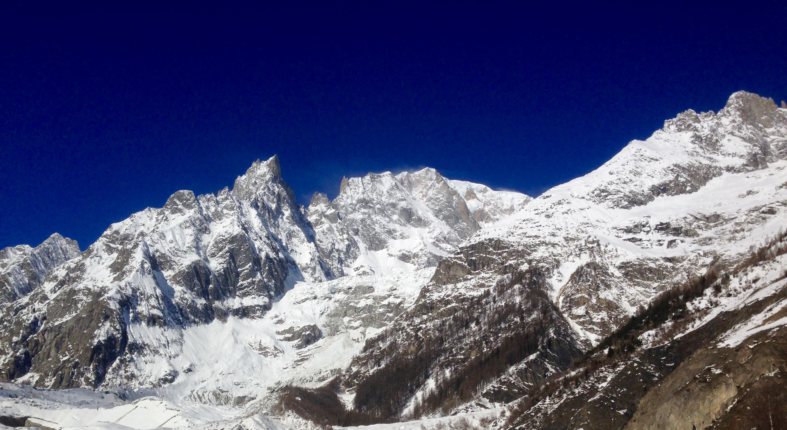
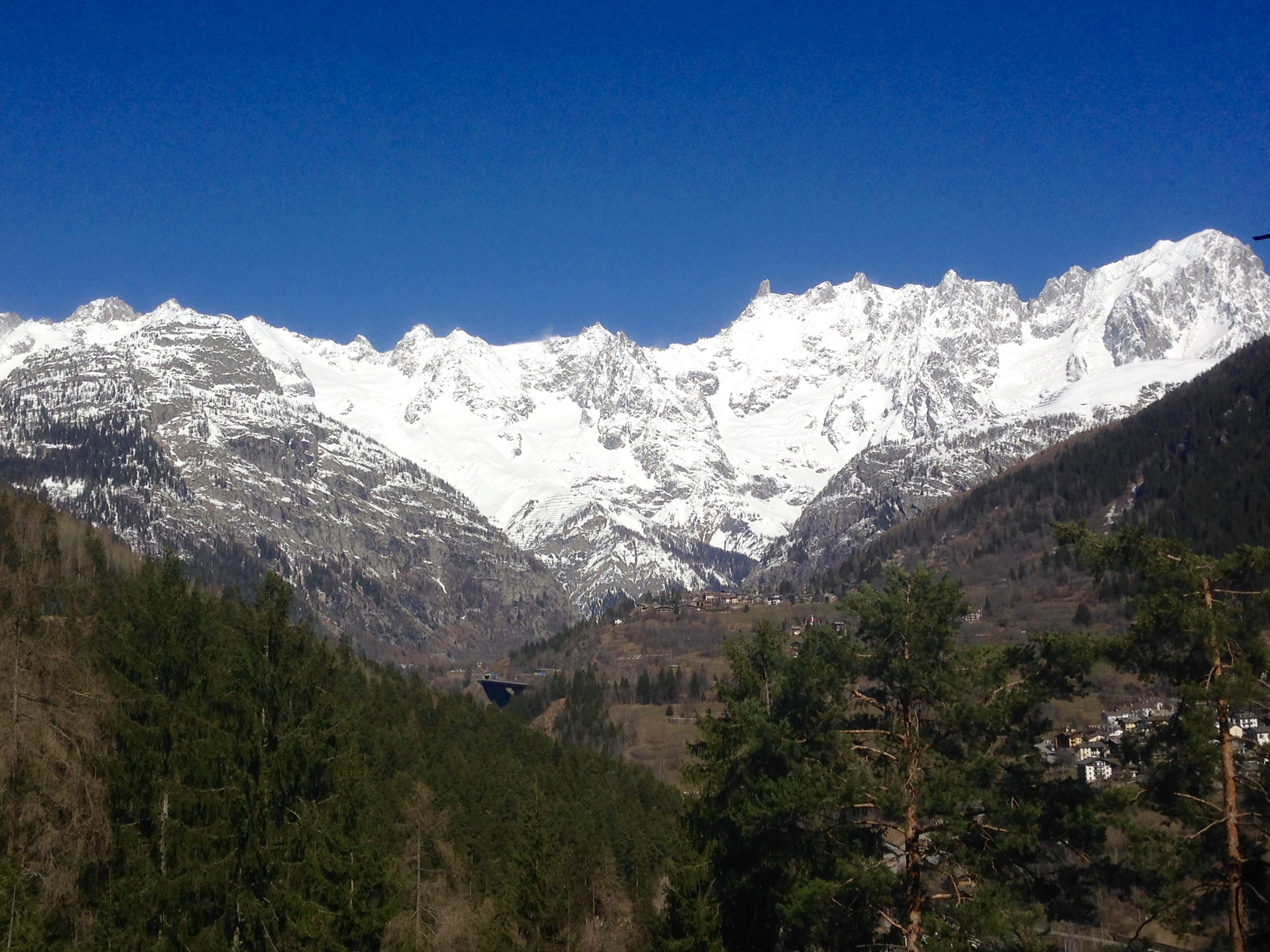
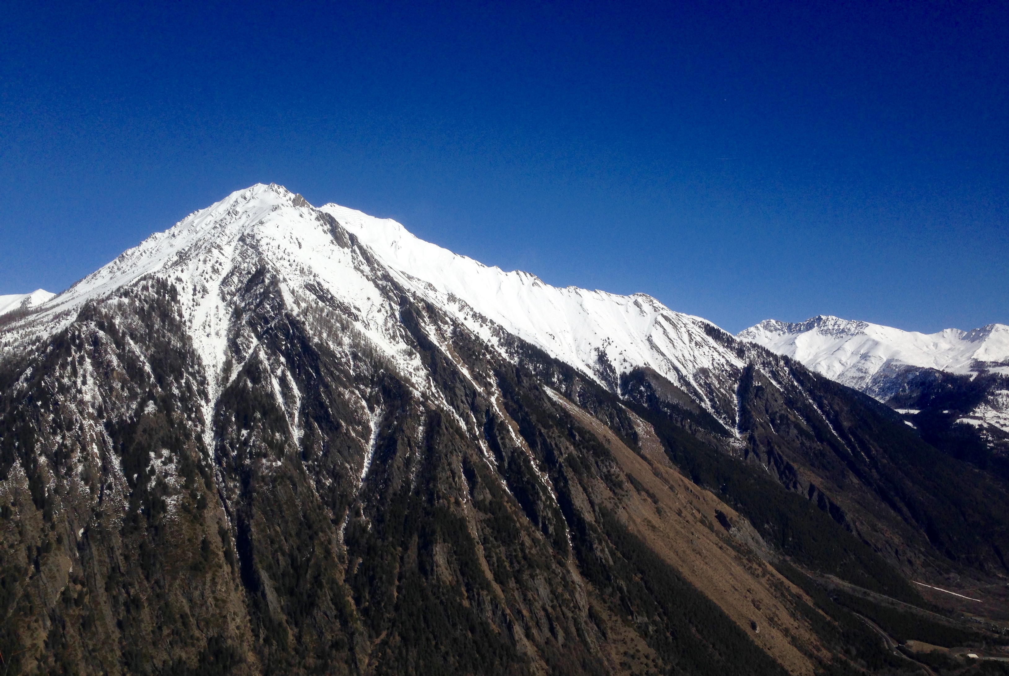
Lured by the prospect of sensational weather, amazing scenery and trails, friendly locals and delicious post-run food, Fitzy and I headed off for a day of trail running around the stunning Italian mountain town of Courmayeur on, as some refer to it, “the sunny side of Mont Blanc”.
Located in the Aosta Valley in north-west Italy, around a 90 minute drive from Geneva via the Mont Blanc Tunnel, it’s no surprise that Courmayeur, like it’s French neighbour to the north, Chamonix, is a trail running paradise. It features in the legendary 170km Ultra Trail du Mont Blanc (UTMB) and hosts the start of the UTMB’s “little sister”, the 101km CCC, or Courmayeur-Champex-Chamonix, which, according to the organizers sets off in “an atmosphere that only Italians can provide, a rare emotional moment to the music of Vangelis”. Golly. It also boasts it’s own 105km Gran Trail race, not to mention the 330km Tor des Geants among others. It even has a Canmore Trail Culture equivalent in the Courmayeur Trailers.
Plan A for the day was to run some run-able parts of the Val Ferret, a truly stunning valley that heads north-eastwards along the bottom of the Mont Blanc massif, with stunning views of the Grandes Jorasses.
Looking towards the Grandes Jorasses in the Val Ferret Photo: Canmore Runner
However, the closure of the Val Ferret due to the extreme avalanche risk put paid to that and so we headed a short distance past Courmayeur to the village of Palleuseiux. Our plan B was to pick a up the number 1 hiking trail from Palleusieux back up the Aosta valley towards Dolonne and Courmayeur along the banks of the Dora Baltea river. Again, the avalanche risk scuppered our plan but undeterred, and after a quick map consultation, we continued down the valley a few minutes to the small spa town of Pre Saint Didier. From here, plan C was to pick up the number 6 hiking trail, and proceed up and into the, hopefully sun drenched and relatively snow free, Thuile Valley and basically take it from there. And that’s what we did, and wow, as Plan Cs go it was superb. It might have been a relatively short 8km out-and-back-ish but what it lacked in distance it more than made up for in ascent (1,416m), challenging trails and incredible views.
On Strava, it all looked like this:
We began at the rather luxurious looking QC Terme Pre Saint Didier thermal baths from where you can pick up a trail that leads you into the bottom of a very steep-sided gorge before heading up the side of the gorge along a series of relatively steep but mostly run-able switchbacks:
Photo: Canmore Runner
..with some beautiful views…
Photo: Canmore Runner
Photo: Canmore Runner
After around a kilometer or so, the trail flattens out and takes you to the the Parco Avventura Mont Blanc. Follow the trail to the car park at the far end of which you will see a sign for the number 6 hiking trail. Follow the number 6 which continues to wind it’s way up (emphasis on up) along the side of the valley:
Photo: Canmore Runner
At around the 2.6km mark, we caught a first glimpse of the valley opening up and got a sense that good things weren’t all that far off:
Looking towards La Thuile – Photo: Canmore Runner
And sure enough, it wasn’t much longer before we reached some abandoned buildings…
Photo: Fitzy
from which we were presented with views like this:
Photo: Canmore Runner
At this point, the trail splits and you can either continue to follow the number 6 and now number 3 hiking trails along the valley towards the village of Elevaz or, as we did, follow the marked trail that continues to zig zag up the side the valley. After around 1km we completely lost the trail under a foot of snow and resorted to a combination of bush-wacking and post-holing, albeit with a great backdrop:
Photo: Canmore Runner
This continued for the next 700m, more or less straight up towards Monte de la Nonna in the hope that at some point we would be able to see back along the Aosta Valley towards Mont Blanc. That point soon arrived and we were not disappointed. First there was Monte Corme to the east:
Photo: Canmore Runner
And then Mont Blanc in all its splendour:
Mont Blanc – Photo: Canmore Runner
By this stage, overwhelming though the views were, we were also beginning to fixate on the delicious food aspect of this Italian road trip and promptly retraced ours steps to the trailhead:
Photo: Fitzy
…drove back to Courmayeur and got on with the serious business of ordering foccacia e birra in very poor Italian:
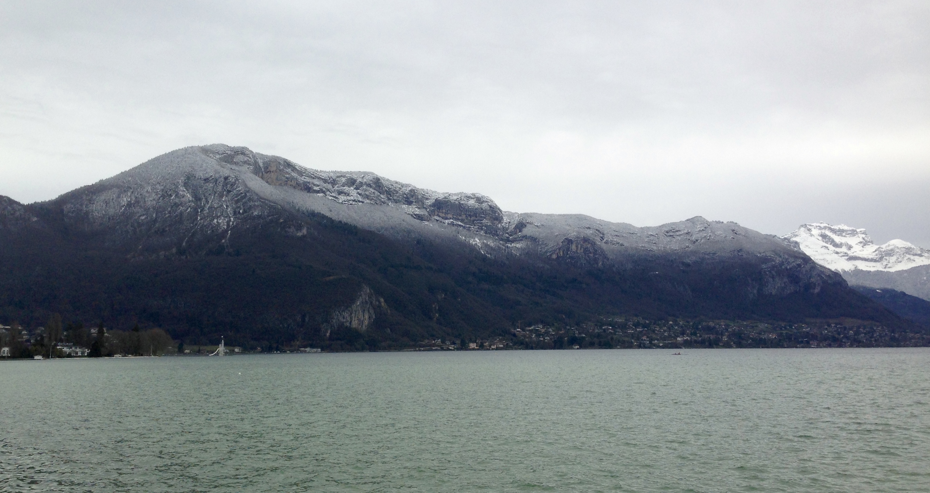
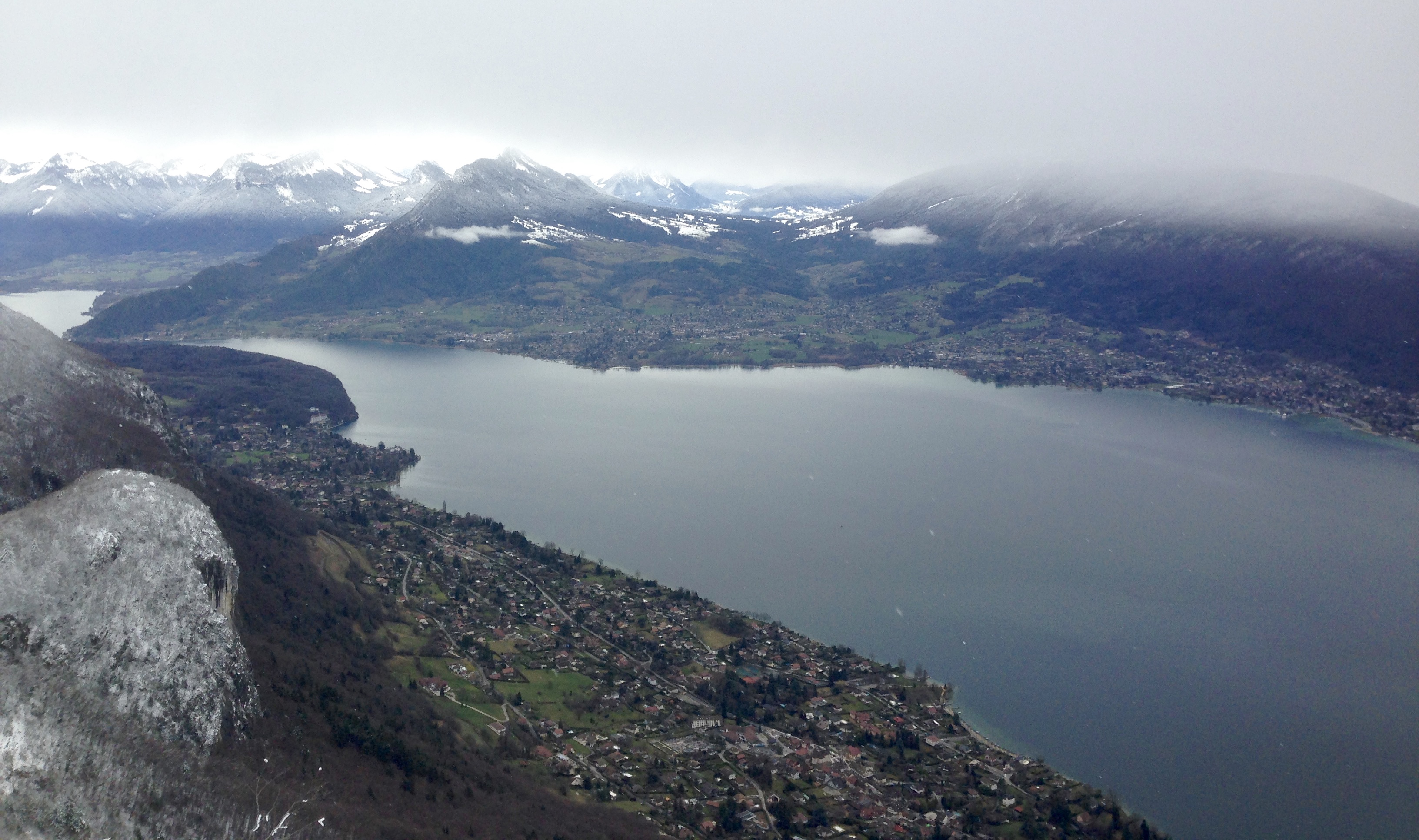
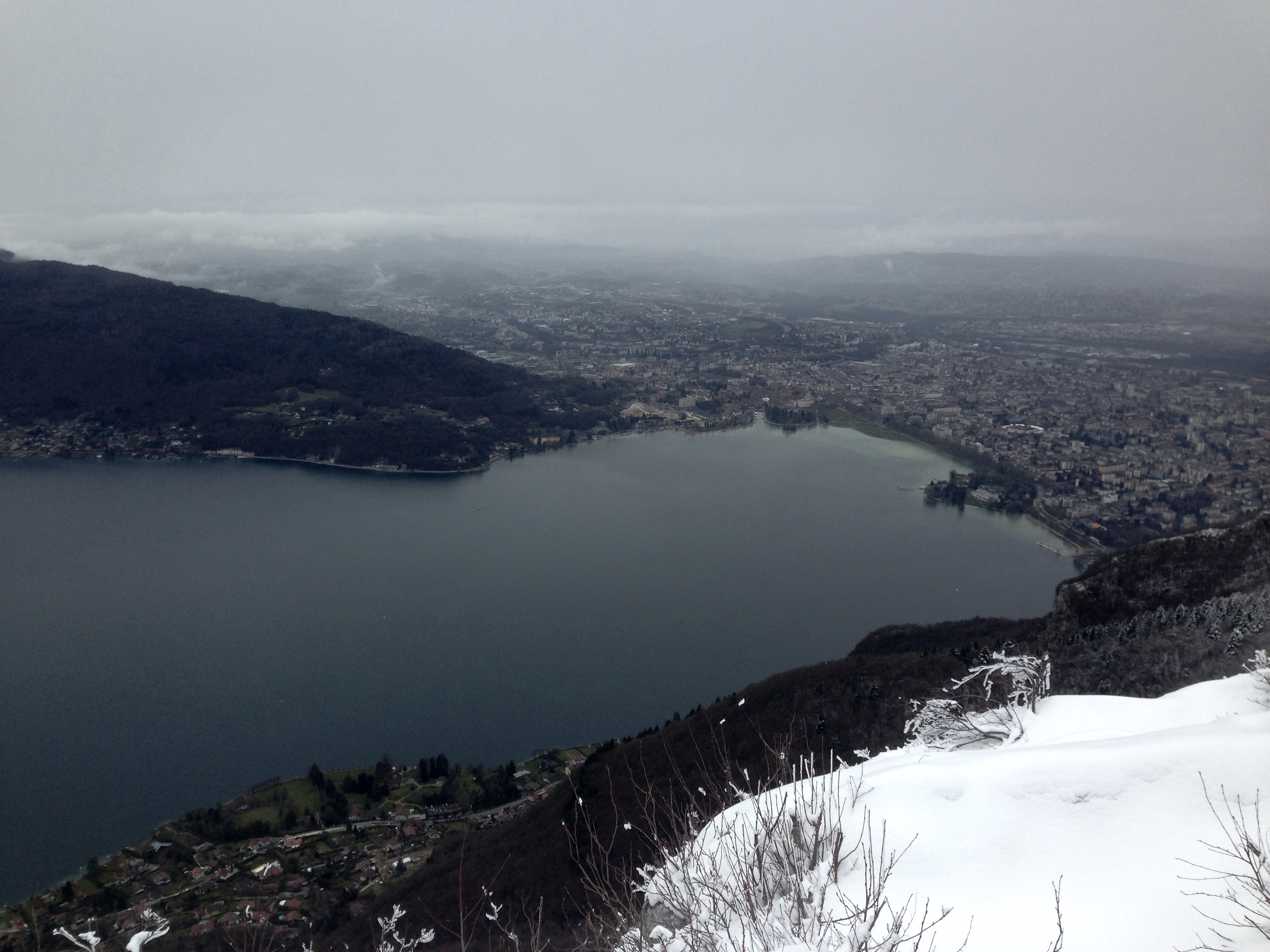
Annecy, France. A mere 25 minute drive from Geneva, the “Venice of the Alps“, home to those gear gurus Salomon, and, it turns out, some spectacular trails.
Joined – all the way from Canmore – by Fitzy, my much missed running companion and leader of Canmore Trail Culture, our objective for the day was an 18km loop with, according to Strava, 2370m of climbing (not sure that’s right) up and over the summit of Mont Baron, on the east side of the beautiful (even on a grey day) Lac d’Annecy:
Monts Baron and Veyrier. Photo: Canmore Runner
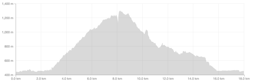
You can shorten this run by a good 5km if, unlike us, you choose to begin at or near the trailhead, rather than parking in town and running along the lake front. It seemed like a good idea when we arrived but a terrible idea two and a half hours later as I laboured back along the lake front. On Strava, it all looked like this:
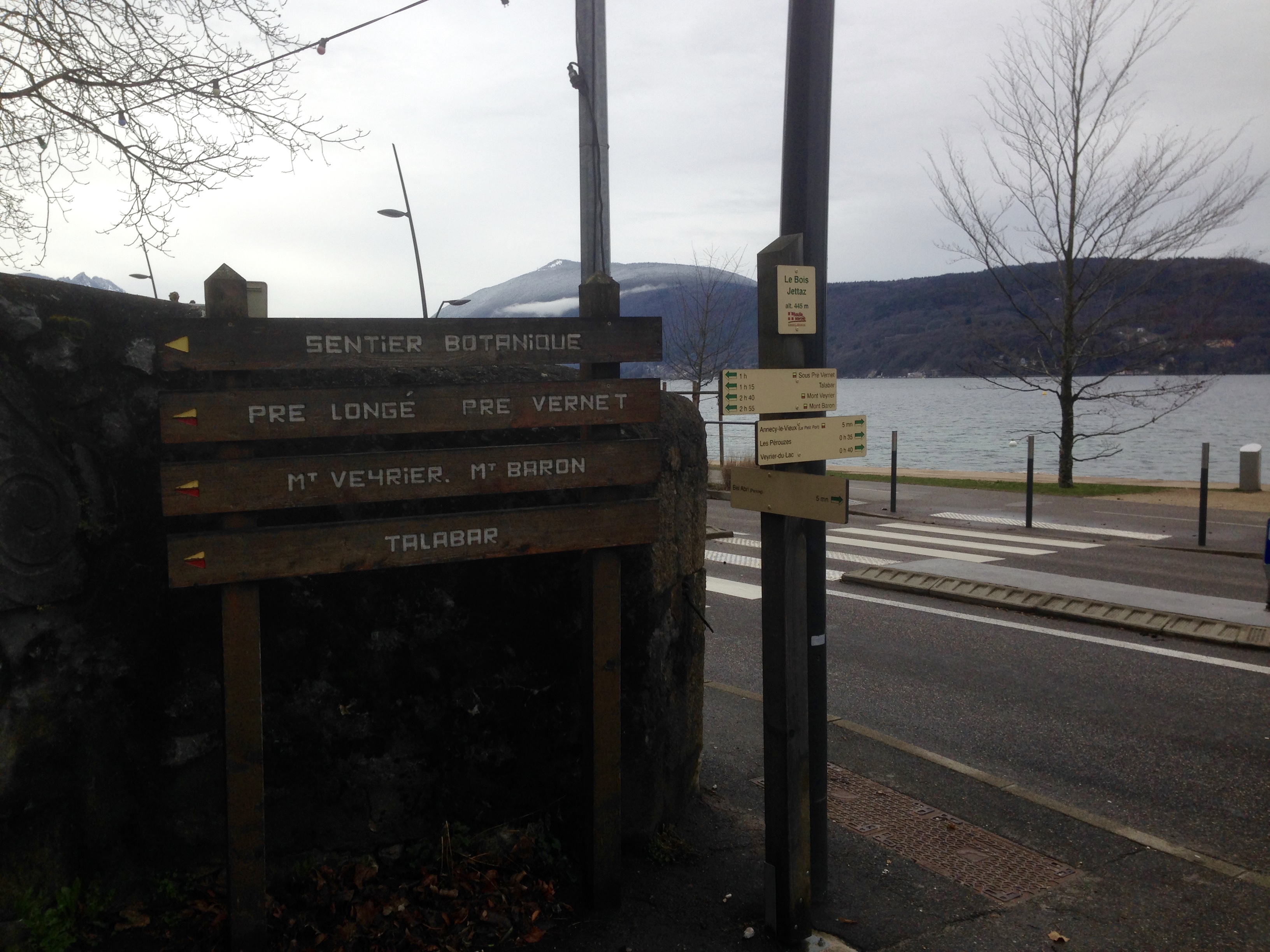
The trailhead is located just off the D909 which is the road that follows the east side of the lake heading from Annecy towards Veyrier-du-Lac. It’s reasonably well signposted:
Photo; Canmore Runner
..and the trailhead is quite obvious:
Photo: Canmore Runner
But if you are in any doubt, just look for this wonderful sight: Ecrin des Gourmandises Boulanger, right smack dab at the trailhead, with the most amazingly dense and delicious pain au chocolat aux amandes. This was surely shaping up to be a good day.
Photo: Canmore Runner
A word to the wise, however. Tempting though it will be, don’t stuff your face because from here it’s more or less uphill for the next 5.4km and the start is steep and rocky:
Fitzy, showing little sign of jet lag – Photo: Canmore Runner
And it more or less continues like that all the way to the Plateau du Mont Baron. The route is relatively straightforward – just keep following the signs for Mont Baron and Mont Veyrier, of which there were quite a few:
Photo: Fitzy
The climb is a beautiful twisting affair, that takes you around the backside of the mountain with a few dips long the way to give you the chance to recover.
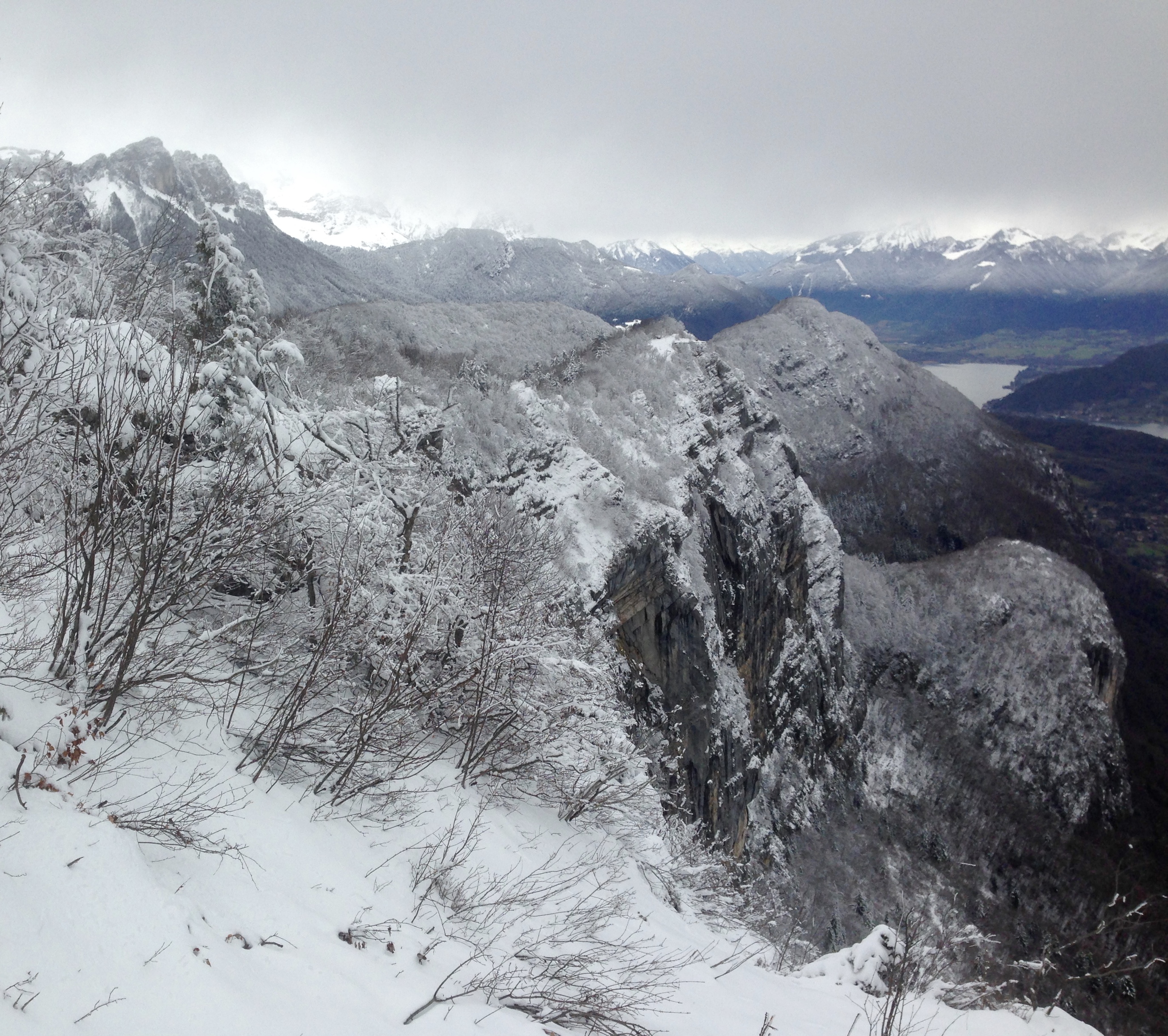
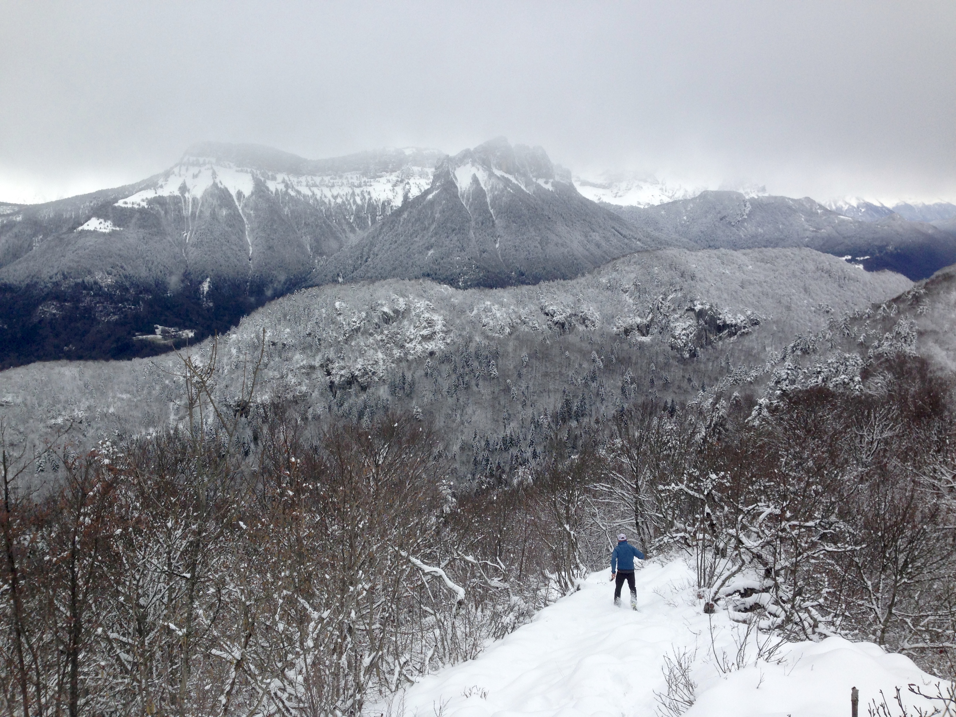
If we’d studied the map a little more carefully, we would probably have taken the steeper trail that heads off to the Col des Sauts and Mont Veyrier around 2.5km from the trailhead and from where you can run along a balcony to Mont Baron. But alas, we didn’t study the map carefully and headed to Mont Baron via the Creux du Loup. But I wouldn’t say we were disappointed. It was something of a winter wonderland:
Photo: Fitzy
You’re in the trees for most of the climb to the Plateau du Baron, which would probably be quite welcome in the heat of the summer. But you just know that the trees will give way at some point and spectacular things await and so they do. A mere 300m further on from the Plateau and the trail brings you to this:
Photo: Canmore Runner
Photo: Canmore Runner
Photo: Canmore Runner
From here, you keep heading along the balcony and the trail drops down a bit:
Photo: Canmore Runner
…before eventually delivering you in around 500m to the Ancien Telepherique:
Photo: Canmore Runner
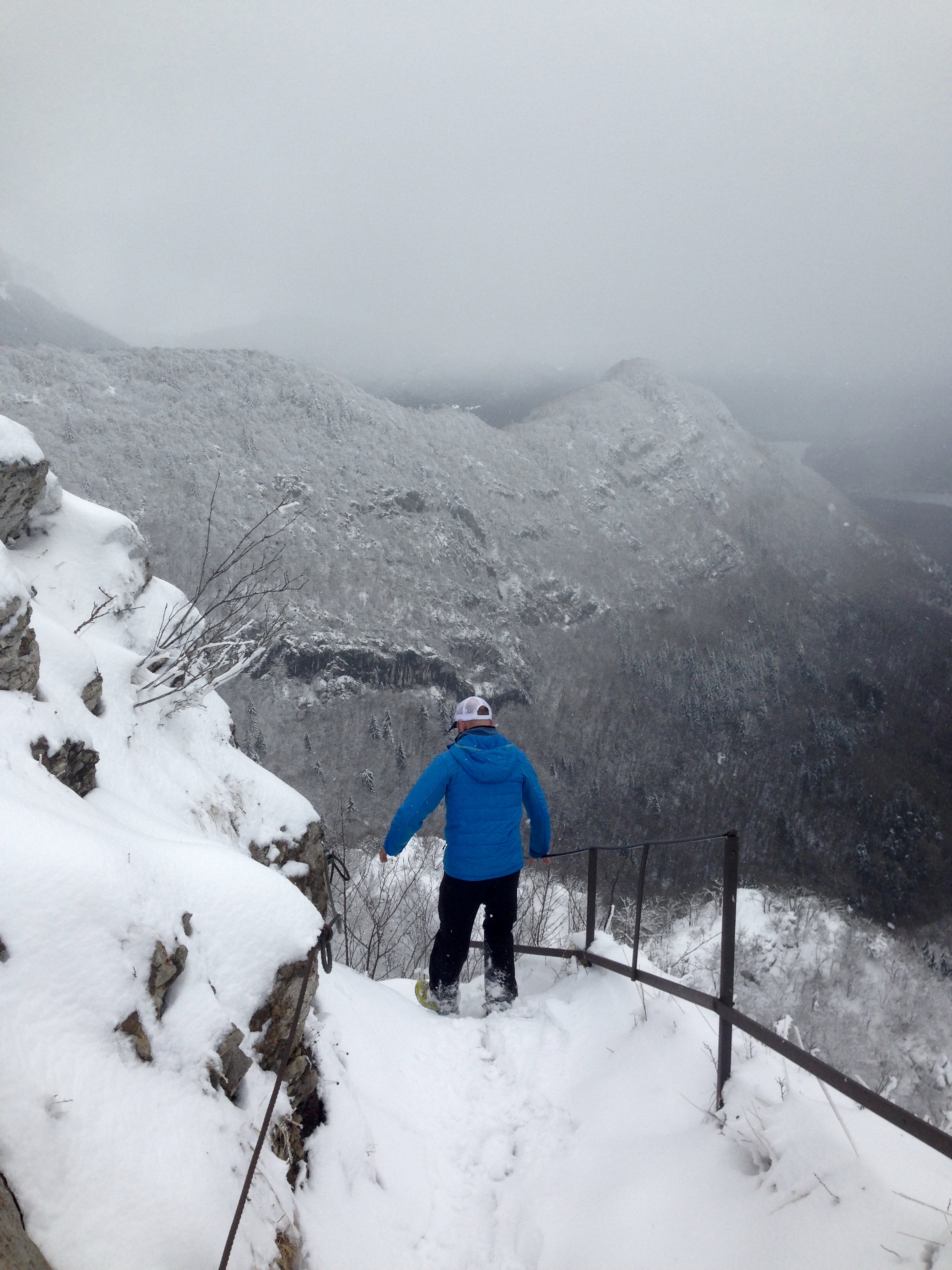
From here, we took the trail down towards Veyrier-du-Lac which involves navigating a slightly steep and sketchy staircase, albeit with a great view:
Photo: Canmore Runner
At the Balcon des Contrabandiers, we continued to follow the signs for Veyrier-du-Lac which took us down a wonderful free flowing singletrack with lots of hairpins and chance to really open up the legs.
Photo: Canmore Runner
Photo: Fitzy
Rather than heading into Veyrier-du-Lac, we followed the trail that was signposted for the Col de Sauts and Mont Veyrier but later dropped off this and onto the trail leading to Chavoire and Talabar. This eventually put us back on the trail we’d started out on from the trailhead which, of course, led us happily back down to the boulangerie.
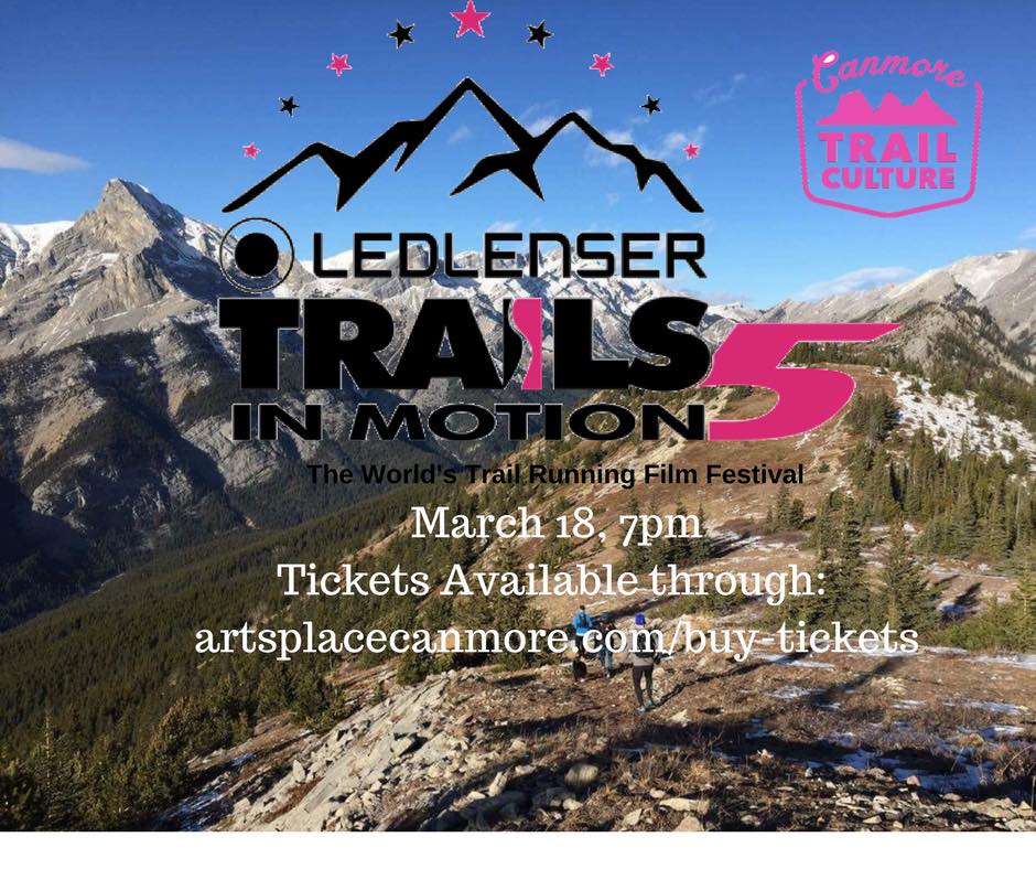
The screening will take place on 18 March at the fabulous artsPlace in downtown Canmore, starting at 7pm. Tickets are $15 in advance and $20 at the door. Tickets can be purchased in advance directly from artsPlace here.
In case you didn’t know: “The Ledlenser Trails In Motion Film Festival is an annual international film tour that brings a collection of the finest trail and ultra running films to passionate audiences around the world. Join like-minded trail runners and adventure sports enthusiasts at film festival-styled events in almost 30 countries as they come together to celebrate the culture and the community of the sport, all hosted by people who love to share this “dirty art” with their local running communities.”
More information on this year’s films can be found on the Trails in Motions website. Or you can check out the trailer:
View from Sanson’s Peak, looking towards Tunnel Mountain, the Bow River and Lake Minnewanka – on a day that was, weather-wise, nothing like the day that I ran Sulphur Mountain – Photo: Canmore Runner
Sulphur Mountain, 2,451m elevation and, it turns out, a total treat. I hadn’t expected it to be thus. This was never on my ever-burgeoning list of “must-do runs”, partly because of its status as one of Banff’s major tourist attractions. Every summer, thousands of tourists take the 8-minute gondola ride to Sanson’s Peak, or hike there from the Upper Hot Springs along a series of switchbacks that wind their way up beneath the gondola. Of course, there has to be a reason why it’s so popular and it might just be the “breathtaking vistas in every direction” and the “stunning bird’s-eye view of six incredible mountain ranges”. As luck would have it, you can still enjoy those same vistas while mostly avoiding the masses en route by taking an alternative and challenging 8km trail to Sanson’s Peak that begins at the Cave and Basin historic site. Continue reading →